Taiwan Strait Map: The Complete Guide to the Most Strategic Waterway in Asia
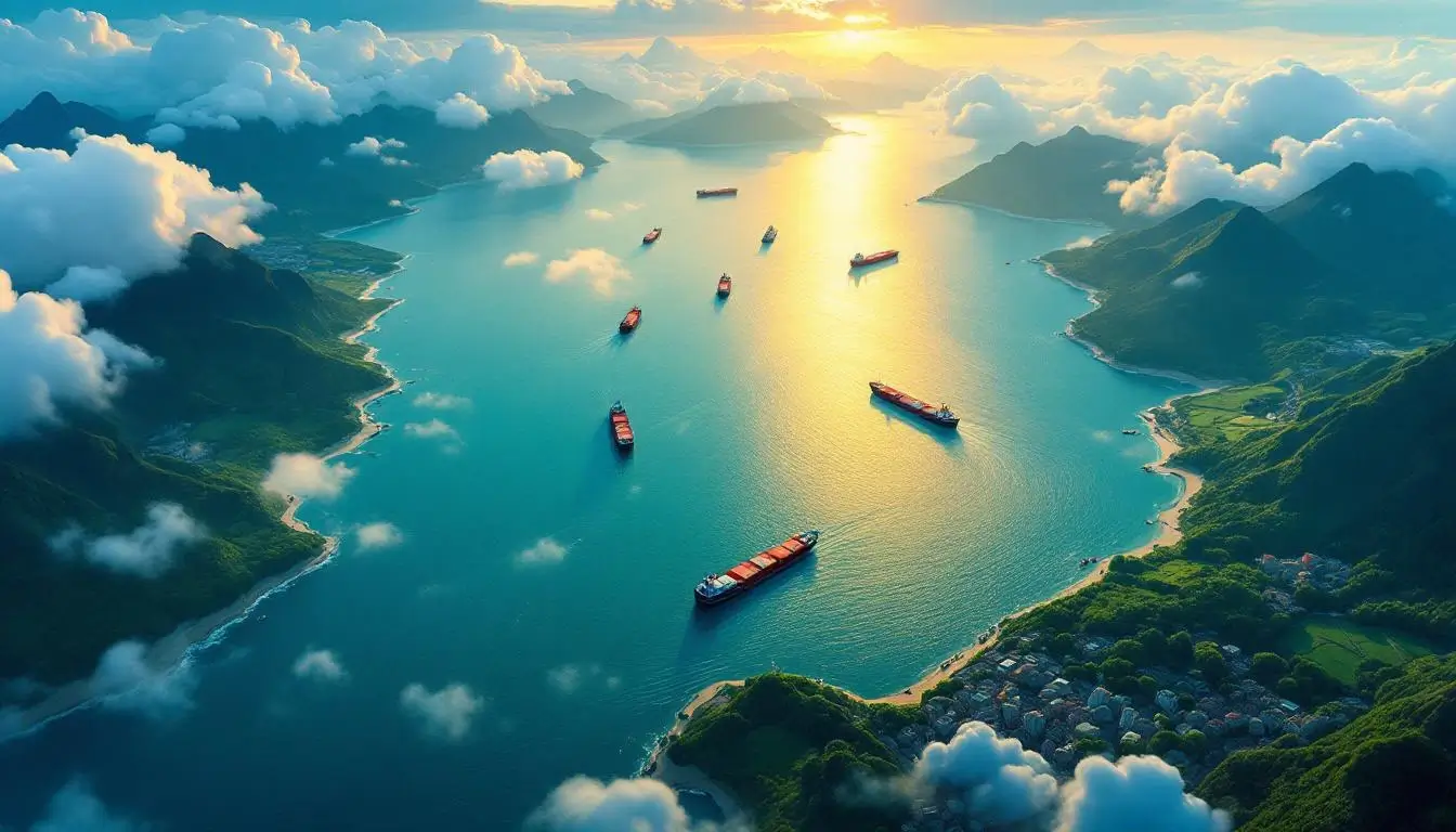
Look at any Taiwan Strait map and you’ll immediately notice something striking: a narrow ribbon of water — barely 130 kilometers at its slimmest point — separating two of the most consequential landmasses in modern geopolitics. This unassuming body of water between Taiwan and mainland China is one of the busiest shipping corridors on the planet, a historical flashpoint that has brought superpowers to the brink of conflict, and the reason your smartphone exists at all.
Whether you’re a geography enthusiast studying the Taiwan Strait map for the first time, a traveler planning a trip across the water, or someone trying to understand why this particular stretch of ocean dominates international headlines, this guide covers everything you need to know. We’ll break down the strait’s exact dimensions, explore its dramatic history, explain why it matters more than ever in 2026, and answer every question you’ve ever had about this fascinating waterway.
What Is the Taiwan Strait? Geography and Location on the Map
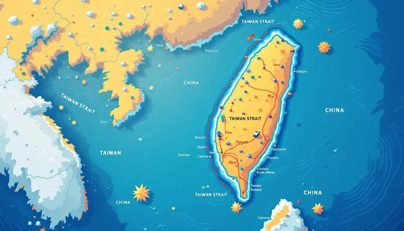
The Taiwan Strait — also known as the Formosa Strait, the Taiwan Haixia (台灣海峽), or historically the Black Ditch (黑水溝) — is the body of water that separates the island of Taiwan from mainland China’s Fujian Province. On a Taiwan Strait map, you’ll find it nestled in the western Pacific, connecting the East China Sea to the north with the South China Sea to the south.
Here’s what makes the geography so compelling. Taiwan itself is a mountainous island roughly the size of Maryland, sitting about 180 kilometers off the southeastern coast of China. The strait runs in a roughly northeast-to-southwest direction, acting as both a natural barrier and a critical maritime corridor between two of Asia’s most dynamic economies.
Key Geographic Facts at a Glance
- Length: Approximately 350 kilometers (220 miles) from north to south
- Width: Ranges from 130 km (81 miles) at the narrowest point to 220 km (140 miles) at the widest
- Narrowest point: Between Taiwan’s Hsinchu County and China’s Pingtan Island in Fujian
- Average depth: About 60 meters (200 feet) — surprisingly shallow for such a strategically important waterway
- Maximum depth: Roughly 90 meters (300 feet) in the deepest channel
- Bordering regions: Fujian Province (China) to the west, Taiwan to the east
The relatively shallow depth of the Taiwan Strait is a legacy of the last Ice Age. Around 10,000 years ago, sea levels were low enough that Taiwan was actually connected to the Asian mainland by a land bridge. Taiwan’s indigenous peoples — 16 distinct Austronesian tribes — are believed to have crossed this land bridge thousands of years before it was swallowed by rising seas.
Islands Within the Strait
The Taiwan Strait isn’t just open water. Several island groups dot the waterway, and their control has been a source of tension for decades:
- Kinmen (Quemoy/金門): Just 2 kilometers from the Chinese city of Xiamen, this Taiwanese-controlled island group was the site of fierce bombardment during the Taiwan Strait Crises of the 1950s. Today it’s a popular tourist destination where you can literally see mainland China from the beach.
- Matsu (馬祖): A chain of 36 small islands 10 kilometers from China’s Fuzhou, governed by Taiwan. Known for the stunning Blue Tears bioluminescence phenomenon that lights up the coastline at night.
- Penghu (澎湖/Pescadores): An archipelago of 90 islands in the middle of the strait, famous for its wind-sculpted basalt columns, pristine beaches, and some of the best seafood in all of Taiwan.
- Pingtan Island: China’s closest point to Taiwan, home to a massive cross-strait economic zone and the starting point for the planned (but not yet built) Taipei–Fuzhou undersea tunnel.
Taiwan Strait Map Through History: From the Black Ditch to the Cold War

The Taiwan Strait’s story is far more dramatic than its calm blue waters suggest. For centuries, this narrow channel has shaped the destinies of empires, nations, and millions of people on both sides.
The Black Ditch Era (Pre-1895)
Early Chinese settlers called the strait the Black Ditch (黑水溝) because of its treacherous currents and dark, deep-looking waters. Crossing it was genuinely dangerous — storms, pirates, and unpredictable currents claimed countless lives. A popular saying from the Qing Dynasty era went: “Six out of ten who cross will die, three will survive, and one will turn back.”
Despite the danger, waves of migration from Fujian and Guangdong provinces flowed across the strait from the 17th century onward, establishing the Hoklo and Hakka communities that form the backbone of Taiwan’s vibrant culture today.
The Japanese Colonial Period (1895–1945)
After Japan’s victory in the First Sino-Japanese War, the 1895 Treaty of Shimonoseki ceded Taiwan to Japan. For the next 50 years, the strait became an international boundary between Japan’s colonial empire and China. The Japanese developed Taiwan’s infrastructure extensively — building railways, ports, and agricultural systems — many of which still influence the island’s modern transportation network, including the corridors that would eventually host the Taiwan High-Speed Rail.
The Taiwan Strait Crises (1954–1958)
The most dramatic chapter in the strait’s history came during the Cold War. After the Chinese Civil War ended in 1949, the defeated Nationalist government under Chiang Kai-shek retreated to Taiwan, maintaining control of the offshore islands of Kinmen and Matsu.
The First Taiwan Strait Crisis (1954–55) erupted when the People’s Republic of China began shelling Kinmen and seized the nearby Yijiangshan Islands. The United States responded by passing the Formosa Resolution, authorizing President Eisenhower to defend Taiwan and its outlying islands. The crisis ended after China ceased fire, but tensions remained stratospheric.
The Second Taiwan Strait Crisis (1958) saw even more intense bombardment. China launched a massive artillery barrage on Kinmen — an estimated 480,000 shells in just 44 days. The United States escorted Taiwanese supply ships to the besieged islands, bringing the two nuclear superpowers dangerously close to direct conflict.
The Kinmen bombardment didn’t fully stop until 1979, when the U.S. and PRC established formal diplomatic relations. For over two decades, shells fell on the islands on alternating days — eventually containing propaganda leaflets instead of explosives.
The Third Taiwan Strait Crisis (1995–96)
Fast forward to the 1990s. When Taiwan’s President Lee Teng-hui made an unofficial visit to the United States in 1995, China responded with a series of missile tests that bracketed Taiwan — firing missiles that splashed down in waters just 30 miles from Taiwan’s major ports. The U.S. dispatched two aircraft carrier battle groups to the strait in what became the largest American military deployment in Asia since the Vietnam War.
This crisis is widely credited with accelerating Taiwan’s democratization and cementing its distinct political identity. It also fundamentally shaped how both Beijing and Washington approach the strait today.
Why the Taiwan Strait Map Matters in 2026: Chips, Trade, and Global Power

If you’ve ever wondered why a body of water barely wider than the English Channel commands so much global attention, the answer comes down to three words: semiconductors, shipping, and sovereignty.
The Silicon Shield
Taiwan produces over 60% of the world’s semiconductors and more than 90% of the most advanced chips (under 7 nanometers). TSMC — the Taiwan Semiconductor Manufacturing Company — is effectively the beating heart of the global tech economy. Every iPhone, every NVIDIA GPU, every advanced military system relies on chips manufactured on an island separated from a potential adversary by just 130 kilometers of water.
This concentration of chipmaking capacity on one side of the Taiwan Strait has been called Taiwan’s “silicon shield” — the theory being that the global economy’s dependence on Taiwanese chips makes any military action across the strait too economically catastrophic to contemplate. Whether that theory holds is one of the defining geopolitical questions of our era.
A Global Shipping Superhighway
The Taiwan Strait is one of the world’s most critical shipping chokepoints. Approximately 88% of the world’s largest container ships passed through the strait in 2024, carrying everything from consumer electronics to raw materials. Any disruption here doesn’t just affect Asia — it ripples through every economy on Earth.
Speaking of iconic Taiwanese things that have traveled across this famous strait to reach the world — if you’re the kind of person who geeks out over Taiwan’s cultural exports, you’ll appreciate wearing your love for the island. The Apple Sidra Taiwan Beverage Logo Vintage T-Shirt is a nod to one of Taiwan’s most beloved retro drinks — perfect for anyone who knows their Taiwanese pop culture.
The Military Dimension
China’s People’s Liberation Army has dramatically increased military activity near the strait in recent years. Regular air and naval incursions across the median line — an informal boundary that runs down the middle of the strait — have become routine since 2022. Taiwan’s military scrambles fighter jets almost daily in response.
Meanwhile, the United States and allied navies conduct “freedom of navigation” transits through the strait, asserting that it constitutes international waters. China disputes this characterization, claiming the strait falls under its sovereign jurisdiction. This fundamental disagreement over the Taiwan Strait map’s legal status remains one of the most dangerous flashpoints in international relations.
Wear Your Taiwan Pride
Rep one of Taiwan’s most iconic retro beverages with this vintage-style Apple Sidra tee. A conversation starter for anyone who knows their Taiwanese culture.
Navigating the Taiwan Strait: Shipping Routes and Maritime Traffic
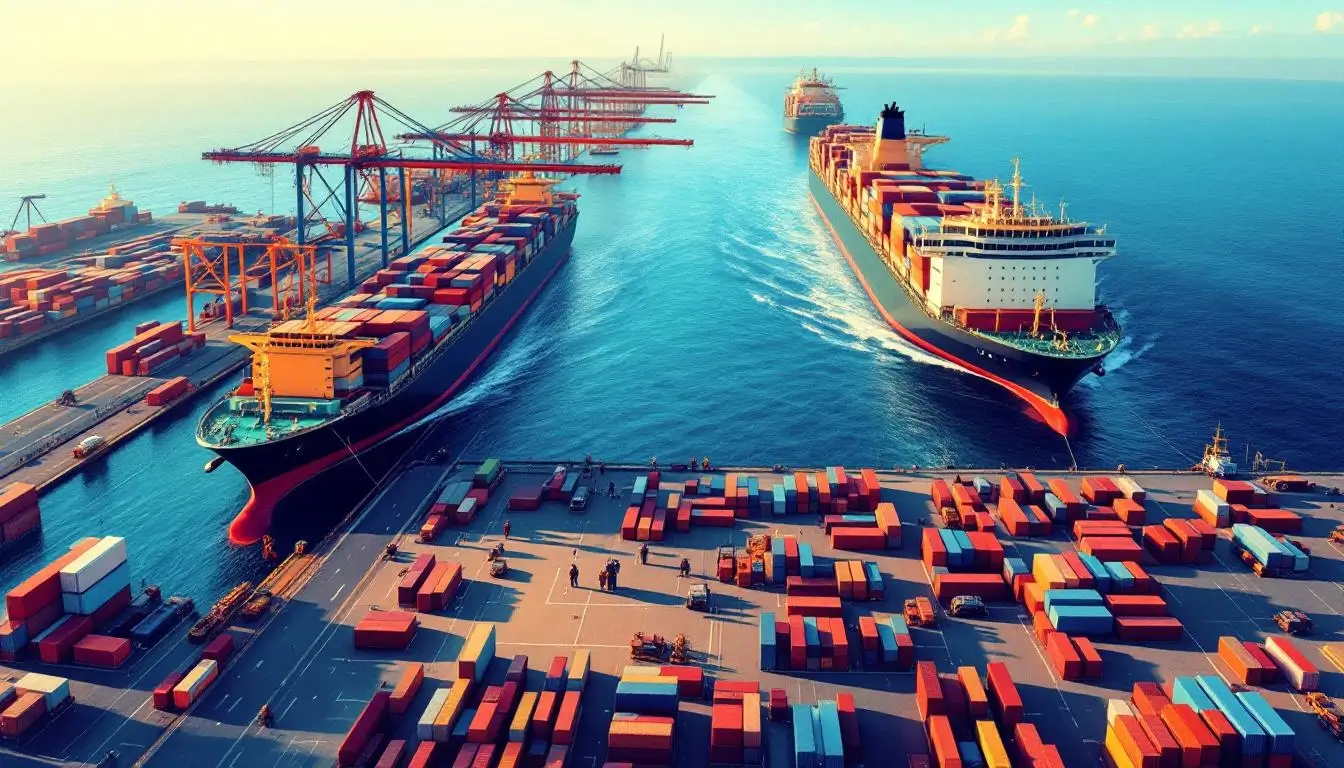
Beyond the geopolitical drama, the Taiwan Strait is a working waterway — one of the busiest maritime corridors in the entire world. Understanding how ships actually navigate this strait reveals just how central it is to daily global commerce.
The Numbers Are Staggering
Every year, roughly half of the global container fleet transits the Taiwan Strait. In terms of trade value, an estimated $2.45 trillion worth of goods passed through in 2024 alone. To put that in perspective, that’s more than the entire GDP of Italy flowing through a channel narrower than some American states.
The strait handles critical cargo including:
- Semiconductors and electronics — Chips manufactured in Taiwan’s science parks heading to assembly plants across Asia
- Energy supplies — Liquefied natural gas (LNG) and crude oil shipments bound for Japan, South Korea, and Taiwan
- Raw materials — Iron ore, coal, and agricultural commodities moving between Southeast Asia and Northeast Asia
- Consumer goods — Everything from clothing to furniture manufactured in China heading to global markets
Major Ports on Both Sides
A Taiwan Strait map of maritime infrastructure reveals major ports flanking both sides of the waterway:
Taiwan side:
- Kaohsiung Port — Taiwan’s largest and busiest port, handling over 9 million TEUs (twenty-foot equivalent units) annually. It’s the 15th busiest container port in the world.
- Taichung Port — Taiwan’s second-largest port, a major hub for bulk cargo and industrial materials
- Keelung Port — Northern Taiwan’s primary port, increasingly popular as a cruise ship destination
China side:
- Xiamen Port — Fujian’s largest port, directly facing Kinmen island across just 5 kilometers of water
- Fuzhou Port — A growing logistics hub with ambitions to become a cross-strait trade center
- Quanzhou/Jinjiang Port — Historic trading port that was once the starting point of the Maritime Silk Road
Cross-Strait Ferry Routes
Despite the political tensions, civilian ferry services regularly cross the Taiwan Strait — though only between specific ports. The “Mini Three Links” (小三通) route connects Kinmen to Xiamen in just 30 minutes, while ferries also run between Matsu and Fuzhou. These routes are popular with Taiwanese business travelers, tourists, and the large community of Taiwanese people working in mainland China.
For travelers planning a broader Taiwan adventure, our complete Taiwan travel itinerary guide covers the best routes across the island itself — from Taipei all the way down to the southern beaches of Kenting.
Understanding the Legal Status: International Waters or Chinese Territory?

One of the most contested questions about the Taiwan Strait map is deceptively simple: who owns these waters?
The International Law Perspective
Under the United Nations Convention on the Law of the Sea (UNCLOS), countries can claim a 12-nautical-mile territorial sea from their coastline. Since the Taiwan Strait is approximately 70 nautical miles wide at its narrowest point, a substantial corridor of international waters (also called “high seas” or more precisely, an exclusive economic zone) exists in the middle.
The United States, Japan, Australia, Canada, and most Western nations consider the central portion of the strait to be international waters, meaning any vessel — military or civilian — has the right to transit freely.
China’s Position
China disputes this interpretation. Beijing has increasingly characterized the Taiwan Strait as falling under Chinese sovereignty, arguing that both sides of the strait belong to “one China.” Chinese officials have pushed back against foreign naval transits, calling them “provocative” and a threat to regional stability.
In practice, this disagreement manifests in regular standoffs. When a U.S. destroyer sails through the strait, China typically shadows it with its own warships and issues diplomatic protests. Japan made headlines in April 2025 when it sent a warship through the strait for the first time, signaling a shift in the regional security dynamic.
The Median Line
For decades, an informal median line (also called the “Davis Line”) running down the center of the strait served as an unofficial boundary. Military aircraft and vessels from both sides generally respected this invisible border. However, following U.S. House Speaker Nancy Pelosi’s visit to Taiwan in August 2022, China conducted large-scale military exercises that deliberately crossed the median line — and has continued to do so regularly since. Many analysts consider the median line effectively erased.
To understand more about where Taiwan sits in the broader world map and why its position matters so much, check out our comprehensive location guide.
Taiwan Strait Map FAQ: Your Questions Answered
How wide is the Taiwan Strait?
The Taiwan Strait varies from approximately 130 kilometers (81 miles) at its narrowest point between Hsinchu, Taiwan and Pingtan, China, to about 220 kilometers (140 miles) at its widest. For comparison, the English Channel between England and France is only 34 kilometers at its narrowest — making the Taiwan Strait roughly four times wider.
Can you see China from Taiwan?
From mainland Taiwan itself, you cannot see China — the distance is too great. However, from the Taiwanese-controlled island of Kinmen, you can absolutely see the Chinese city of Xiamen just 2 kilometers away. On clear days, Xiamen’s skyscrapers are clearly visible from Kinmen’s beaches. Matsu also offers views of the Chinese coastline.
How deep is the Taiwan Strait?
The Taiwan Strait is surprisingly shallow, averaging about 60 meters (200 feet) deep with a maximum depth of approximately 90 meters (300 feet). This shallow depth is because the strait sits on the continental shelf — during the last Ice Age, when sea levels were lower, it was actually dry land that people walked across.
Is the Taiwan Strait international waters?
This is actively disputed. The United States and most Western nations consider the central corridor of the Taiwan Strait to be international waters, allowing free passage for all vessels. China considers the strait to fall under its jurisdiction. Since the strait is about 70 nautical miles wide at its narrowest — well beyond the 12-nautical-mile territorial sea limit — international law generally supports the international waters interpretation for the central portion.
How long would it take to cross the Taiwan Strait?
By ferry, the shortest crossing takes about 30 minutes (Kinmen to Xiamen). A theoretical direct crossing from mainland Taiwan to mainland China — if such a route existed — would take roughly 2-3 hours by fast ferry. By cargo ship, a transit through the full length of the strait takes approximately 10-12 hours depending on speed and routing.
Has anyone swum across the Taiwan Strait?
No one has completed a direct swim across the full width of the Taiwan Strait from Taiwan to mainland China (130+ km). However, several swimmers have completed shorter crossings between outlying islands. The strong currents, shipping traffic, and political sensitivities make a full crossing extraordinarily challenging and practically impossible to organize.
What military forces are in the Taiwan Strait?
Both Chinese and Taiwanese naval and air forces maintain a constant presence in and around the strait. China’s Eastern Theater Command oversees military operations in the area, regularly deploying fighters, bombers, and warships. Taiwan’s navy and air force monitor the strait 24/7 from bases on the western coast. The United States periodically transits warships through the strait, and other nations including Canada, France, Germany, and Japan have also conducted strait transits in recent years.
Final Thoughts: The World’s Most Watched Waterway

The Taiwan Strait map tells a story that goes far beyond geography. This narrow channel of water is where ancient migration routes, Cold War frontlines, 21st-century trade networks, and the world’s most important technology supply chain all converge in a space barely wider than a long drive down the highway.
For the millions of people living on both sides — from the fishermen of Penghu to the tech workers of Hsinchu, from the tea farmers of Fujian to the night market vendors of Kinmen — the strait isn’t an abstract geopolitical concept. It’s the water they see from their windows, the route their ancestors crossed, and the backdrop to their daily lives.
Understanding the Taiwan Strait map means understanding one of the most consequential pieces of geography on Earth. Whether the strait remains a place of peaceful commerce or becomes something else entirely is one of the defining questions of our time. What’s certain is that this 350-kilometer stretch of water will continue to shape history — just as it has for the past several thousand years.
Curious to learn more about the incredible island on the eastern shore of this famous strait? Explore our guides to Taiwan’s traditional food, discover why it’s called the Kingdom of Fruits, or start planning your own visit with our best time to travel to Taiwan guide.

Grab a Free Taiwan Sticker!
Drop your email and we’ll send you a limited-edition Taiwan sticker — plus insider access to new merch drops and island vibes.
No spam. Unsubscribe anytime.