Taiwan Map World: Where Is Taiwan and Why This Tiny Island Matters
If you’ve ever tried to find Taiwan on a world map, you know it can be surprisingly tricky. This leaf-shaped island sits at one of the most strategically fascinating crossroads on Earth — where the western Pacific meets East Asia, sandwiched between major powers and surrounded by some of the busiest shipping lanes on the planet. Understanding where Taiwan sits on the taiwan map world view isn’t just a geography lesson — it’s the key to understanding why this tiny island punches so far above its weight in culture, technology, and global influence.
Whether you’re planning your first trip, studying for a geography quiz, or just curious about the island that gave the world bubble tea and the best night markets in Asia, this guide breaks down everything you need to know about Taiwan’s position on the world map — from its exact coordinates to its volcanic mountain ranges, its maritime neighbors, and the outlying islands that most maps don’t even bother to show.
Where Is Taiwan on the World Map?
Taiwan sits in the western Pacific Ocean, approximately 160 kilometers (100 miles) off the southeastern coast of mainland China. Its capital, Taipei, is located at coordinates 25°02’N latitude, 121°38’E longitude — placing it firmly in both the Northern and Eastern hemispheres.
On a standard taiwan map world projection, you’ll find Taiwan roughly where the East China Sea meets the South China Sea, positioned along the Tropic of Cancer. The island occupies a critical position on the Pacific Ring of Fire, the 40,000-kilometer horseshoe-shaped zone known for frequent earthquakes and volcanic activity. This geological position is exactly what gave Taiwan its dramatic mountainous terrain — but more on that later.
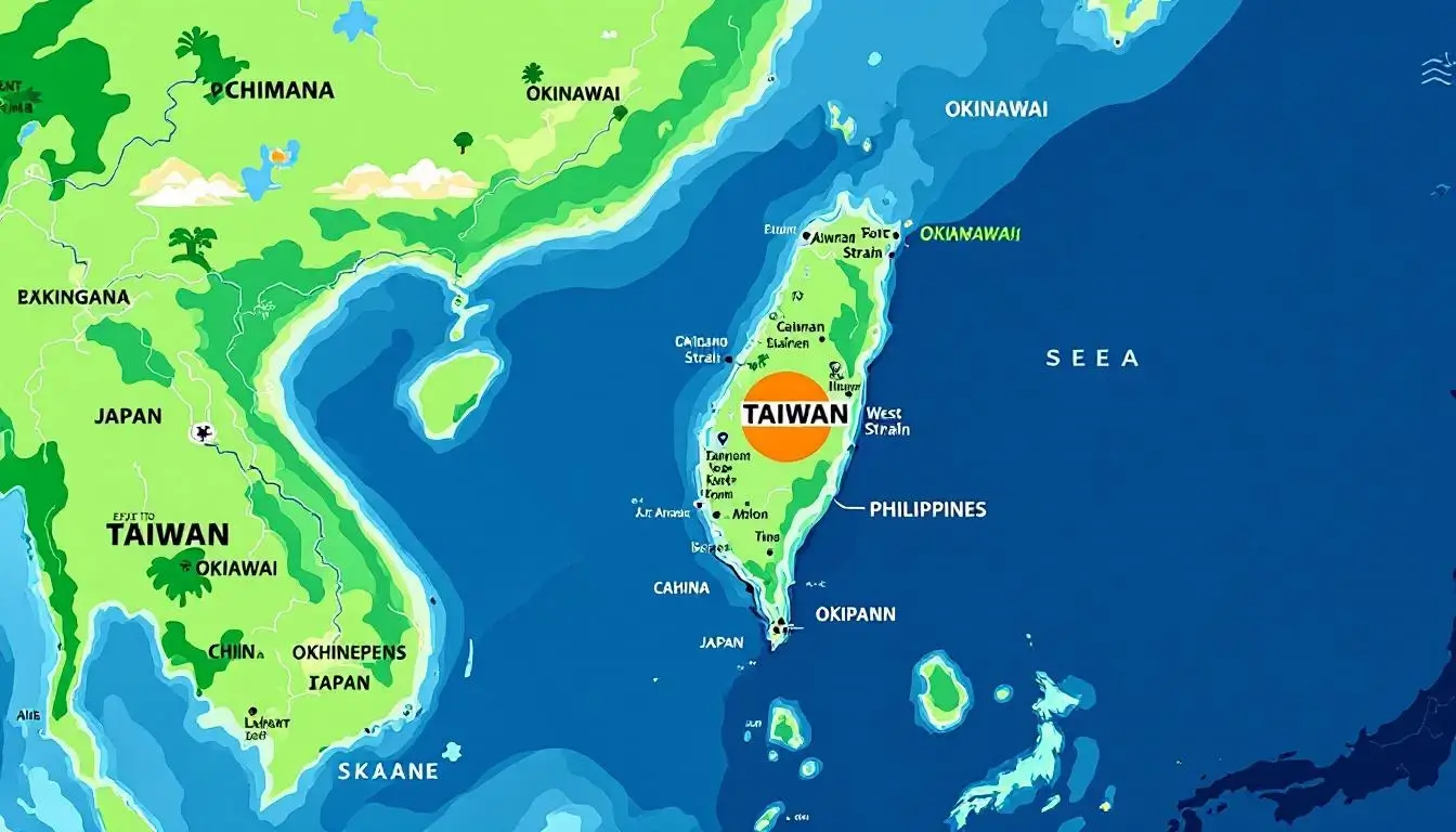
To orient yourself quickly: Taiwan is about the same latitude as Hawaii, sits directly south of Japan’s Okinawa islands, and is roughly north of the Philippines. If you draw a line from Shanghai straight south along the Chinese coastline, Taiwan appears as a distinctive leaf-shaped island just off the coast, separated by the narrow Taiwan Strait.
Here’s what makes Taiwan’s position genuinely unique on the world map — it sits at the intersection of three tectonic plates (the Eurasian, Philippine Sea, and Okinawa plates). This triple junction creates the geological drama that defines everything about the island, from its towering peaks to its legendary hot springs that attract millions of visitors every year.
Taiwan’s Neighbors: Every Country and Sea Surrounding the Island
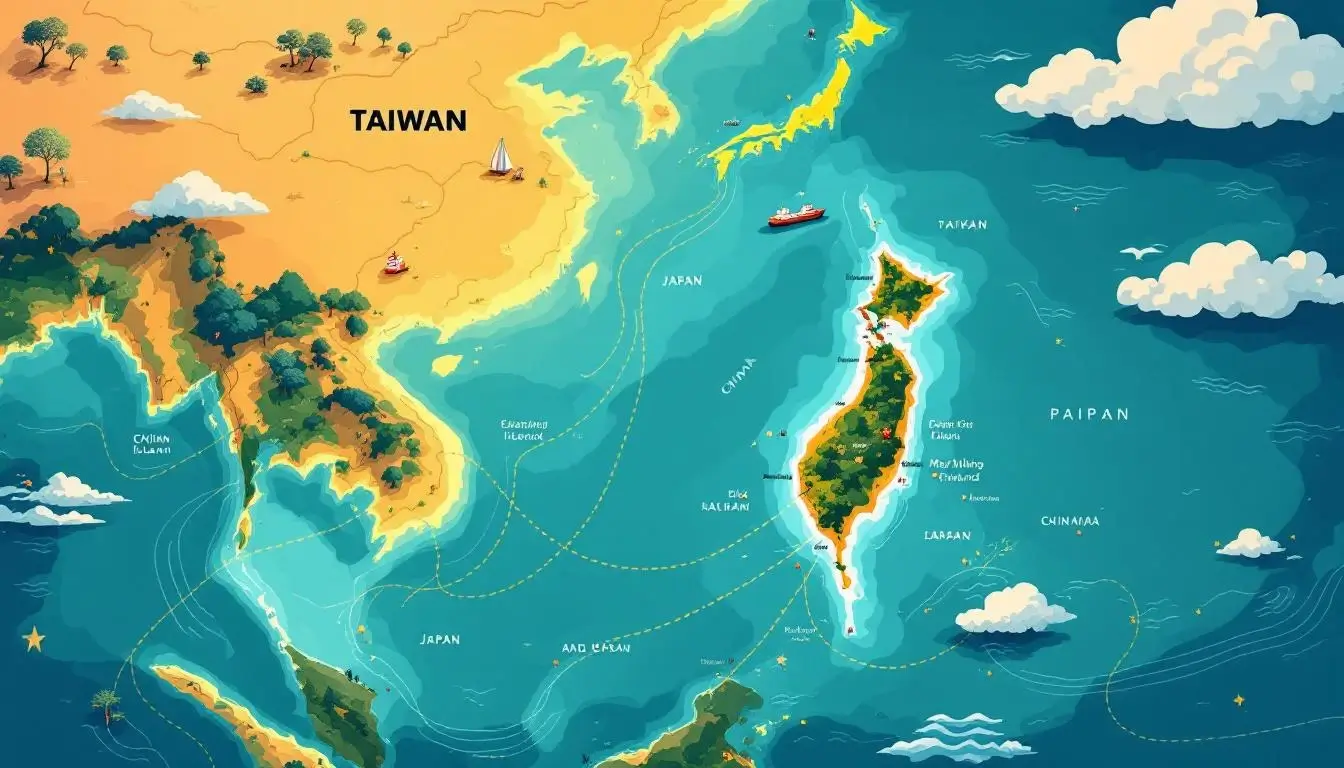
Understanding Taiwan’s neighborhood on the world map reveals why this island has been a crossroads of culture and commerce for centuries. Taiwan doesn’t share any land borders — it’s entirely surrounded by water — but its maritime neighbors have profoundly shaped its history, cuisine, and cultural identity.
Countries Nearest to Taiwan
China (West) — Mainland China lies just 130 kilometers across the Taiwan Strait at the narrowest point. The Chinese provinces of Fujian and Zhejiang are Taiwan’s closest continental neighbors. Historically, waves of migration from Fujian province brought the Hokkien language and traditions that still define much of Taiwanese culture today.
Japan (Northeast) — Japan’s Ryukyu Islands (Okinawa chain) extend to within about 110 kilometers of Taiwan’s northeastern tip. The Japanese colonial period (1895-1945) left lasting marks on Taiwanese architecture, cuisine, and infrastructure — you’ll still find Japanese-era railway stations, hot spring towns, and a deep love of matcha and izakaya-style dining across the island.
Philippines (South) — The Bashi Channel separates Taiwan from the northern Philippines by roughly 350 kilometers. The warm Kuroshio Current flows northward through this channel, giving Taiwan’s southern coast a tropical climate that supports coral reefs and palm-lined beaches.
Seas and Waterways
- Taiwan Strait (West) — The 180-kilometer-wide strait separating Taiwan from mainland China. One of the world’s busiest shipping corridors, with over half of global container traffic passing through annually.
- East China Sea (North) — Extends from Taiwan’s northern coast up toward Korea and Japan’s Kyushu island.
- Pacific Ocean (East) — Taiwan’s rugged eastern coastline drops sharply into the deep Pacific. The Kuroshio Current runs along this coast, creating some of the best whale-watching opportunities in Asia.
- South China Sea (Southwest) — Connects Taiwan to Southeast Asia and some of the world’s most contested waterways.
- Bashi Channel (South) — The deepwater passage between Taiwan and the Philippines, critical for submarine navigation and ocean currents.
This position — surrounded by four different bodies of water and sitting between three major Asian nations — is why Taiwan has historically been called the “crossroads of the Pacific.” Every major maritime trade route between Northeast and Southeast Asia passes within sight of its shores.
How Big Is Taiwan? Size Comparisons That Put It in Perspective
When you see Taiwan on a world map, it’s easy to underestimate just how much is packed into this compact island. Taiwan’s total land area is approximately 36,197 square kilometers (13,976 square miles) — but those numbers don’t mean much without context. Here are comparisons that actually make sense:
Taiwan vs. U.S. States
- Taiwan ≈ Maryland — Maryland covers 32,131 km², making Taiwan slightly larger. But while Maryland is relatively flat, Taiwan crams in nearly 300 peaks over 3,000 meters.
- Taiwan ≈ Massachusetts + Connecticut + Rhode Island combined — This three-state combo is the classic comparison, and it works perfectly for visualizing Taiwan’s footprint.
- Taiwan is roughly 1/4 the size of New York State — yet packs in 23 million people versus New York’s 20 million.
Taiwan vs. Other Countries
- Taiwan ≈ The Netherlands — Nearly identical in area (Netherlands: 41,543 km² including water). Both are densely populated nations with world-class infrastructure squeezed into compact territories.
- Taiwan ≈ Belgium — Belgium at 30,528 km² is slightly smaller, but the comparison works. Both are small nations with outsized cultural and economic influence.
- Taiwan is about 1/10 the size of Japan — yet Japan’s population is only about 5x larger.
The Numbers at a Glance
- Length: 394 km (245 miles) from north to south
- Width: 144 km (89.5 miles) at the widest point
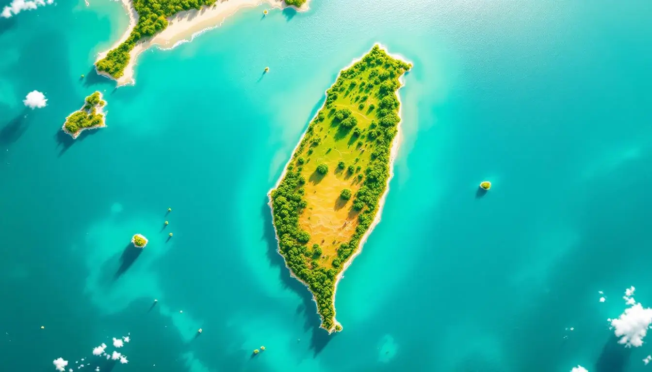
- Shape: Often described as a sweet potato or tobacco leaf — Taiwanese people affectionately call their island fānshǔ (番薯), meaning “sweet potato”
- Coastline: 1,566 km (973 miles) of diverse coastline, from sandy beaches in the south to dramatic cliffs in the east
- Population density: Approximately 650 people per km² — one of the highest in the world
What makes Taiwan’s compact size remarkable is the sheer diversity packed inside. Within a few hours’ drive, you can go from subtropical beaches to alpine forests above 3,000 meters. If you’re planning a trip to Taiwan, this compact geography is actually a huge advantage — you can experience tropical, temperate, and alpine environments all in a single week.
Taiwan’s Physical Geography: Mountains, Rivers, and the Ring of Fire
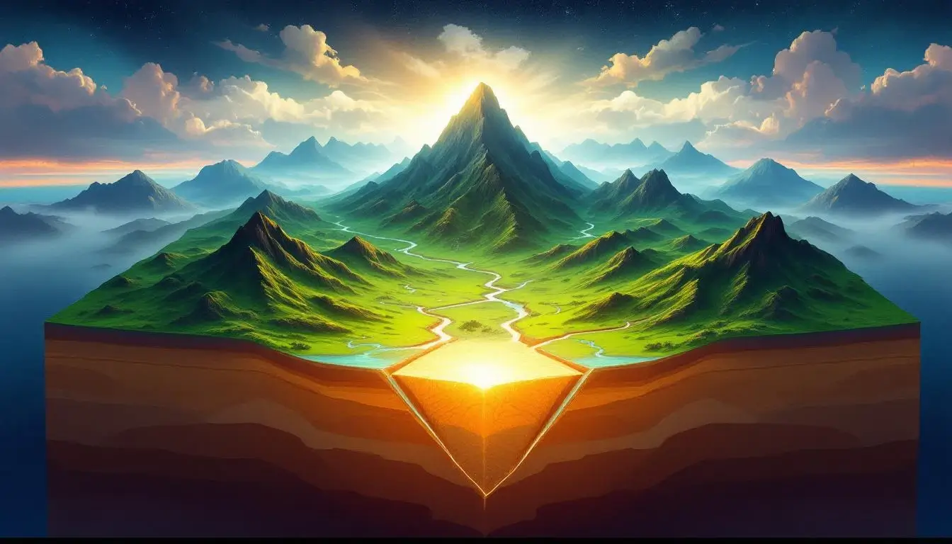
Taiwan’s position on the Pacific Ring of Fire doesn’t just show up on seismic maps — it’s the single most defining feature of the island’s physical geography. The collision of the Philippine Sea Plate with the Eurasian Plate has crumpled Taiwan’s interior into some of the most dramatic mountain terrain in all of Asia.
The Mountain Ranges
Mountains cover approximately 70% of Taiwan’s total land area. The island has 268 peaks above 3,000 meters — more than the European Alps in a fraction of the space. The five major ranges run roughly parallel from north to south:
- Central Mountain Range (中央山脈) — The backbone of Taiwan, extending 340 km from Su’ao in the northeast to Eluanbi at the southern tip. This range is the island’s principal watershed, splitting rivers east and west.
- Xueshan Range (雪山山脈) — Home to Xueshan (Snow Mountain) at 3,886 meters, Taiwan’s second-highest peak.
- Yushan Range (玉山山脈) — Contains Yushan (Jade Mountain) at 3,952 meters — the highest point in Taiwan and the entire western Pacific region. Yushan makes Taiwan the world’s fourth-highest island after New Guinea, Borneo, and Hawaii.
- Alishan Range (阿里山山脈) — Famous for its sunrise views, ancient cypress forests, and the narrow-gauge mountain railway that draws visitors from around the world.
- Coastal Range (海岸山脈) — The easternmost range, running along the Pacific coast with steep cliffs that drop dramatically into the ocean.
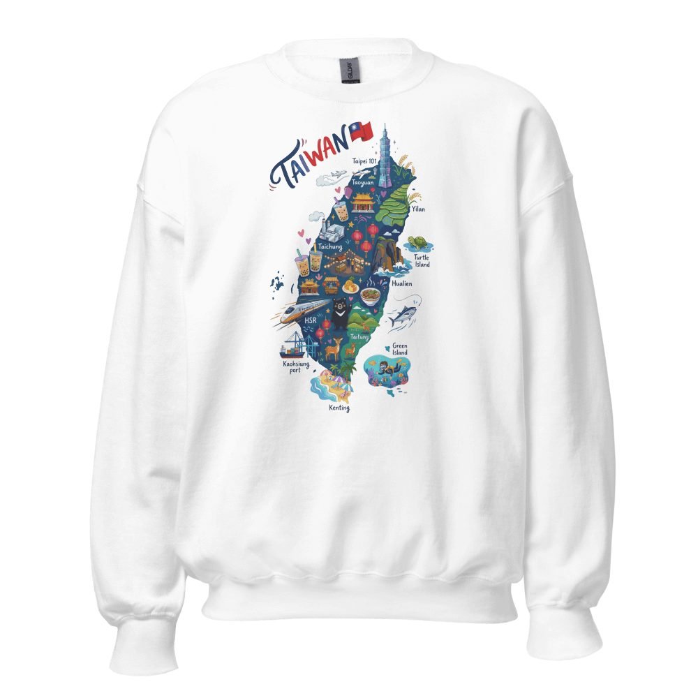
Speaking of Taiwan’s incredible natural landscape — if you love the island’s iconic geography, you might enjoy wearing it. Our Taiwan Illustrated Map Design Crew Neck Sweatshirt features a beautifully illustrated map highlighting Taiwan’s mountains, landmarks, and cultural icons. It’s the perfect way to show off your Taiwan pride.
Major Rivers
Taiwan’s steep terrain means its rivers tend to be short but powerful. The island has over 100 named rivers, most running west from the Central Mountain Range to the Taiwan Strait:
- Zhuoshui River (濁水溪) — Taiwan’s longest river at 186.6 km, flowing through central Taiwan. Its name means “Muddy Water River” due to the sediment it carries from the mountains.
- Gaoping River (高屏溪) — The largest river by drainage basin area, flowing through southern Taiwan near Kaohsiung.
- Tamsui River (淡水河) — The only navigable river in Taiwan, flowing through the Taipei Basin and emptying into the Taiwan Strait near the historic port town of Tamsui (Danshui).
Geological Activity
Taiwan experiences an average of 18,500 earthquakes per year (though most are too small to feel). The island sits at the junction of three tectonic plates, making it one of the most seismically active places on Earth. This same geological energy powers Taiwan’s world-class hot springs — the island has over 100 hot spring sites, from the sulfuric fumaroles of Beitou in Taipei to the remote wilderness springs of Taitung.
Taiwan’s Outlying Islands: The Hidden Gems Most World Maps Miss
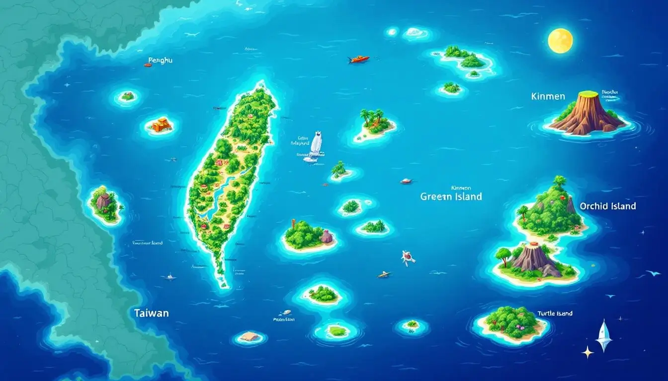
When most people picture Taiwan on the world map, they think of the main island. But Taiwan actually administers over 160 islands and islets scattered across the Taiwan Strait and the Pacific — and several of these outlying island groups are incredible destinations in their own right.
Penghu Islands (澎湖群島)
Located in the middle of the Taiwan Strait, roughly 50 km west of the main island, the Penghu archipelago consists of 90 islands and islets. Known as the “Hawaii of Taiwan,” Penghu offers white-sand beaches, ancient basalt formations, stunning coral reefs, and the oldest Mazu temple in Taiwan (built in 1593). The islands are famous for their double-heart stone weir — an iconic fish trap that’s become one of Taiwan’s most photographed landmarks.
Kinmen (金門) and Matsu (馬祖)
These island groups sit just a few kilometers off the coast of mainland China’s Fujian province — far closer to China than to Taiwan’s main island. Kinmen is just 2 km from the Chinese city of Xiamen, making it one of the most geographically unusual territories in the world. Both island groups are known for their military heritage, traditional Fujian-style stone architecture, and Kinmen’s famous kaoliang sorghum liquor.
Green Island (綠島) and Orchid Island (蘭嶼)
Off Taiwan’s southeastern coast in the Pacific, these two islands offer wildly different experiences. Green Island has world-class diving in coral reefs and one of only three saltwater hot springs on Earth. Orchid Island (Lanyu) is home to the Tao indigenous people, who maintain traditional thatched-roof houses and hand-carved wooden fishing boats — one of the most culturally distinctive communities in all of East Asia.
Turtle Island (龜山島)
Visible from the coast of Yilan County, this volcanic island shaped like a swimming turtle is Taiwan’s only active volcano. Access is strictly controlled to preserve the ecosystem, but seasonal boat tours allow visitors to circle the island and spot dolphins in the surrounding waters.
These outlying islands add significant context to the taiwan map world picture — Taiwan’s territory extends much further than the main island alone, spanning from just off China’s coast to deep into the Pacific.
Wear the Island You Love
Our Taiwan Illustrated Map Crew Neck Sweatshirt features a beautifully designed map highlighting the island’s mountains, landmarks, and cultural icons. Perfect for Taiwan lovers and geography nerds alike.
Frequently Asked Questions About Taiwan on the World Map
What continent is Taiwan on?
Taiwan is geographically part of Asia, specifically East Asia. The main island sits on the continental shelf of the Asian continent, though it’s separated from the mainland by the Taiwan Strait. On most world maps, Taiwan appears in the same region as China, Japan, and South Korea.
Is Taiwan in Southeast Asia or East Asia?
Taiwan is classified as East Asia, not Southeast Asia. Its geographic position — north of the Tropic of Cancer, across from China’s Fujian province, and south of Japan — places it squarely in the East Asian region. However, Taiwan’s southern tip does dip into tropical latitudes, giving places like Kenting a distinctly Southeast Asian feel with coral reefs and tropical forests.
Why is Taiwan sometimes missing from world maps?
Taiwan appears on virtually all geographic and cartographic world maps. However, its labeling can vary. Some maps label it as “Taiwan,” others as “Republic of China (Taiwan),” and some use “Chinese Taipei” — a name used in certain international organizations and sporting events. The labeling differences stem from Taiwan’s unique diplomatic situation, but the island itself is always physically depicted on standard world maps.
How far is Taiwan from China?
At the narrowest point of the Taiwan Strait, Taiwan is approximately 130 kilometers (81 miles) from mainland China’s Fujian province. However, Taiwan’s Kinmen Islands are just 2 kilometers from the Chinese city of Xiamen.
Can you see China from Taiwan?
You cannot see mainland China from Taiwan’s main island — 130 km is far beyond visual range. However, from Kinmen Island, you can clearly see the Xiamen skyline across the water, especially at night when the city lights up.
What time zone is Taiwan in?
Taiwan uses National Standard Time (NST), which is UTC+8 — the same time zone as China, Singapore, Hong Kong, and the Philippines. There is no daylight saving time in Taiwan.
What is the Taiwan Strait?
The Taiwan Strait is the 180-kilometer-wide body of water separating Taiwan from mainland China. It connects the East China Sea to the north with the South China Sea to the south. The strait is one of the world’s most important shipping lanes — roughly half of all global container ships and a significant portion of the world’s LNG tankers pass through it annually.
Where is Taiwan compared to Japan?
Taiwan is located approximately 110 km southwest of Japan’s westernmost Ryukyu Islands (Yonaguni Island in Okinawa Prefecture). Tokyo is about 2,100 km northeast of Taipei. Despite the distance, Taiwan and Japan share deep cultural connections — from hot spring culture to love of convenience stores and breakfast culture that reflects decades of Japanese influence.
Final Thoughts: Why Taiwan’s Spot on the Map Matters
Taiwan’s location on the world map tells a story that goes far beyond coordinates and compass points. This island sits at the exact meeting point of three tectonic plates, four bodies of water, and centuries of cultural exchange between East Asian, Southeast Asian, and Pacific civilizations. It’s this position — geographically, culturally, and economically — that makes Taiwan one of the most fascinating places on Earth.
The same geological forces that pushed Taiwan’s mountains skyward also created the hot springs, volcanic landscapes, and dramatic coastlines that make the island a traveler’s paradise. The same maritime position that made it a crossroads of trade routes brought waves of indigenous, Chinese, Japanese, and European influences that created Taiwan’s unique cultural mosaic — from its incredible food scene to its one-of-a-kind cultural traditions.
Whether you’re zooming in on Google Earth, studying a classroom globe, or planning your first trip to Taiwan, knowing where this island sits on the world map is the first step to understanding why it matters so much. And trust us — once you start exploring Taiwan, whether on a map or in person, you won’t want to stop.

Grab a Free Taiwan Sticker!
Drop your email and we’ll send you a limited-edition Taiwan sticker — plus insider access to new merch drops and island vibes.
No spam. Unsubscribe anytime.